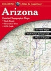
Arizona Atlas & Gazetteer
Scale 1:260,000 (1"=4.1 miles) Contour Interval 300 feet Each Page Covers 41.25 miles x 57.6 miles GPS Grids and tick marks Special Features Shaded relief, Grand Canyon Map & Gazetteer, BLM & state lands, statewide publicly owned lands locator map Pages 56 pp. of maps, 68 pp. in all Copyright 2010