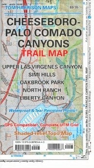
Cheeseboro-Palo Comado Canyons
maps have color-coded symbols and trails, mileages between trail junctions, latitude/longitude, UTM grids, contour lines, vegetation, and elevations at trail junctions.
waterproof & tear resistant plastic
Cheeseboro Canyon pub. 2012, scale 1:31,680 40 & 50 ft contours