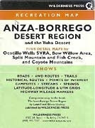
Anza-Borrego Desert Region and the Yuha Desert Recreation Map
Recreation map shows roads, 4WD routes, trails, historical routes, campsites, streams, springs and highway mileage markers Conveniently marked with both UTM and Lat/Lon grids Coverage of Anza-Borrego and Yuha Desert areas as well as Ocotillo Wells SVRA, Bow Willow Area, Split Mountain and Fish Creek and the Coyote Mountains Fully indexed map locations; companion map to the book The Anza-Borrego Desert Region Map of USGS topographic map coverage and location map for detail maps included Useful visitor contact information including web sites and emergency telephone numbers Folded size: 7.25 x 5.5 inches; unfolded size: 21.5 x 28 inches Wilderness Press; 3rd edition, copyright 2006